A spring storm system continues to bring a myriad of weather conditions, including blizzard warnings, gusty winds, freezing rain, heavy rain, and accumulating snow. Numerous warnings remain in effect in Minnesota as this powerful system moves through.
Record warmth yesterday, then a blizzard just 12 hours later — only in Minnesota.
The powerful storm system tracks through the Great Lakes region Saturday. As cooler air wraps around the system, accumulating snowfall is spreading across the western and northern parts of the state.

As rain transitions to snow, freezing rain is possible, primarily in northwestern and western Minnesota, where ice accumulation could range from a tenth to a quarter of an inch.

Northwesterly winds sustained at 25-35 mph, with gusts up to 60 mph, will make travel difficult in areas under a blizzard warning. Falling snow and breezy winds could lead to near white-out conditions.
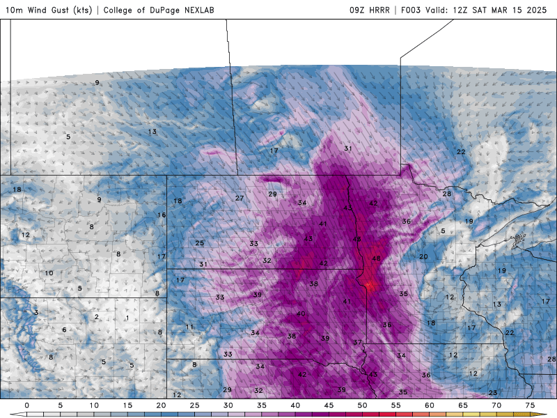
Temperatures will continue to drop throughout Saturday, with afternoon temperatures in the 20s across central and northwestern Minnesota and the 30s in eastern and southern areas.

As the system winds down Saturday night, winds will decrease and accumulating snow will end.
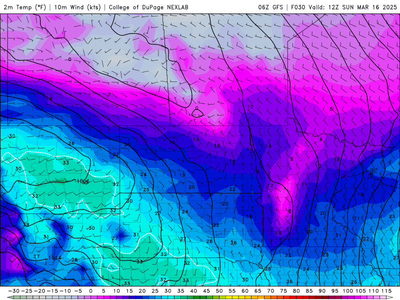
Low temperatures Saturday night will fall into the single digits and teens in northern Minnesota, while the Twin Cities will dip into the 20s. Areas with a fresh snowpack will experience slightly cooler temperatures.

By Sunday morning, wind chills will be at or below zero for central and northern Minnesota, a significant drop compared to our recent temperatures.

Sunshine and high pressure will return on Sunday, bringing temperatures in the 30s and 40s. By Monday, temperatures will climb into the 60s, melting the snowpack ahead of the next spring storm, which is expected to arrive Tuesday into Wednesday.
Collected from Minnesota Public Radio News. View original source here.